Writing "Alsoomse and Wanchese" -- Locating Aquascogooc
The showdown battle I will stage between Wingina’s warriors
and Piemacum’s braves will be just south of the village
of Aquascogooc on the eastern bank of
the Pungo River
I took several weeks to decide where I wanted to locate the
village. Historians do not know the
exact location. Each seems to have his
own opinion of the location. Archeological
digging has revealed several sites containing potsherds of various pottery styles
as well as animal bones, chipped stone, hammerstones, and rocks used as
tools. Stephen Davis, Associate Director
of the Research Laboratories of Archaeology at the University
of North Carolina answered my email
inquiry about the location of the three important archeological sites along the
Pungo River
“These three sites are located on
the east shore of
Pungo
My next task was to determine the route
Wingina’s canoes would take to reach Aquascogooc from Croatoan, where I have
the Dasemunkepeuc and Roanoke braves gather
prior to their crossing Pamlico Sound . Here is an inaccurate map (wrong locations of
Aquascogooc and Secotan and too many openings in the Outer Banks) of where the
crossing would take place. I estimated that
the open-water crossing to Bluff Point on the southeast corner of the Pamlico Sound mainland would be 42 miles. The map gives you some perspective of
distance and risk.
Their journey begins.
It
was definitely arduous. Wanchese knew
it. He had traveled to Aquascogooc once before.
He knew how the wind god could make travel from Croatoan across the
endless waters impossible. The
wind-blown wavelets were striking the canoe’s left side, forcing its five
paddlers – three on the left side – constantly to correct its course. Well
ahead, Wingina’s two long canoes carried his warriors and the women. An entire
day of paddling toward a landless horizon might find them – near the
disappearance of the sun – north of the point of marsh [Bluff Point] shaped
like a deformed foot, or at it, or to the south in vast open water. Finding it,
they would paddle past it and turn north along the saw grass, black needlerush
shoreline to a little creek where they would push the canoes into the marsh
vegetation, eat smoked trout, drink fresh water from their gourds, and arrange
themselves, touching their weapons and each others’ arms and legs, to sleep
until the new day’s rays awakened them.
What follows is the route that the three canoes take to
reach a final destination close to Aquascogooc.
Use this map and move the cursor to follow along.
Second Day
Continue
east past Juniper Bay Point (6.5km/4 miles)
Go through Great Island Narrows to Crab Point before Swanquarter Bay
(8km/5 miles)
Travel through Shell
Narrows north of Swanquarter Island and two islands north of Swanquarter Island
and the huge Judith Island farther north to reach the west end of the long
lateral Swanquarter Island (7.5km/4.7 miles)
Pass through the narrows between the southernmost peninsula of Judith
Island and a smaller island south of it and head northwest to reach Point of
Narrows on the westernmost point of Judith Island. (5.5km/3.4 miles)
Travel slightly northwest in open water to Roos Point, passing the
expansive opening to Spencer Bay (3500m/2.2 miles)
Travel northwest along the swampy coastline past Abel Bay to Currituck
Point and the very wide mouth of the Pungo River (9000m/5.6 miles)
Stay second
night (24.5 miles)
General Information about the Marshland Passed
More than one-half of the Swanquarter National Wildlife Refuge has been designated Wilderness: Judith Island ,
Swanquarter Island ,
Great Island ,
Marsh Island ,
and portions of the mainland along Juniper Bay Great
Islands Marsh
Island Juniper
Bay
Here
are a few pictures to help you
visual this area.
Judith
Marsh
.jpg)
Here is
what one sailboat traveler had to say
about the area.
November 12, 2012 – “We turned back toward North Creek and decided
to take a shortcut behind Judith
Island
My narration:
Wanchese
awoke suffering pain.
His
right shoulder seemed locked in place. He rotated his arm, slowly,
thoughtfully; tightened the center of his face; increased gradually the arc of
the motion. Both knees were sore. Sitting in the bottom of the canoe, he flexed
them. He wondered if standing in the three foot depth of water might soothe
them. Keme was already in the water.
Wanchese
looked westward. The contour of the marsh shoreline meandered. The water was
calm. He looked across the mainland; flat saw grass and needlerush extended
beyond his vision! No place to sit on ground and build a fire. They would again
follow the sun for most of its journey before they found earth upon which to
sleep.
Wanchese labored now at the left side of the canoe, the waves striking
behind when they paddled northwest, against their left side when they traveled
due west, Wanchese could not remember accurately which island of marsh grass,
which passage between islands of marsh grass, which point of a distant marsh
island to be reached over extensive water determined how much farther they had
to labor. His mind fixated on his frustration, and his pain.
While
Wanchese and his companions had rested, while he had been bent over, he had
seen two feet below the surface of the water the drifting shapes of two
speckled trout. He knew that elsewhere in tiny coves and narrow channels red
and black drum and young speckled trout co-existed. Fishing was excellent here
but too far from where a man could hunt, drink fresh water, build a fire, and
sleep! Diverted, he had looked for yellow-bellied turtles and water snakes but
had not been rewarded. He had hoped to see within a partially closed channel a
sleeping alligator. There was hope yet.
…
The sun
was still visible when Tanaquincy returned from attending the meeting of
leaders. They had beached their canoes in a little cove [Hobb Creek] that gave
them some protection against the southwest wind. “You may take your chances sleeping
on land,” Tanaquincy gestured, grimaced. “I will be drier in the canoe.”
“What
have they decided?” Taraquine moved closer to Wanchese, placed his left hand on
Wanchese’s right shoulder. Wanchese winced.
“Ah, too
hard for you?” Tanaquincy grinned. “Today we traveled a little more than half
what we did the sleep before.” He laughed.
“And the
next day we fight,” Wanchese answered.
“No,
actually,” – he paused to enjoy their anticipatory expressions – “ we mostly
rest.”
Wanchese,
Taraquine, and Machk continued to stare.
“We,
Wingina, and Andacon paddle to a meeting place across the river. Where Osacan
and his canoe waits.”
“This river?
This is the river?” Taraquine pointed outside the canoe.
“The River of Many
Taraquine
nodded.
“It has
been an experience,” Machk said. He smiled. “Kiwasa must have enjoyed watching
us.”
“We will
all be spreading tobacco tomorrow on these waters!”
“Where is
this place where we meet?” Wanchese asked quickly. How close to Aquascogooc
would it dare be? he thought.
“Not far.
We have to cross the river, which is very wide. We do not want to be seen
paddling along this side where we know small settlements might be located. Then
we rest, wait for dark. Before first light we go our separate ways.”
Third Day
Cross
the river in the northwest direction to Grass Point (3.4 miles)
Travel up
the west bank to Wilkins Point and enter Jordan Creek and rest (2.6 miles)
During
the night:
Osacon’s Canoe:
Travel north to Woodstock Point (2,2 miles)
Cross the river, arrive just south of fishing Creek, and land occupants
200 meters above Aquascogooc (2.2 miles)
Altogether 4.4 miles
Wingina’s
Two Canoes:
Travel north to Woodstock Point (2.2 miles)
Cross the river due
east and land occupants 200 meters south of Aquascogooc (2.3 miles)
Altogether 4.5 miles
Wanchese’s Canoe:
Cross
the river near dusk in a northeast
direction to Sandy Point near the mouth of Slade Creek (2.2 Miles)
Enter
Slade Creek and travel to July Point 1 mile)
Travel along the north bank to Hog Pen Point (1.75 miles)
Travel
across Slade Creek and enter the mouth of Neal Creek (.5 miles)
Travel up Neal Creek to
its navigable end (1.25 miles)
Travel
overland in a northwesterly direction toward the Indian village to await dawn
(1.7 miles)
Altogether 8.4 miles
The Pungo
River begins in the East Dismal Swamp
in Washington County ,
about 10 miles south of Plymouth Hyde County Pungo River
is connected to the Alligator River by a 21-mile canal, which is part of the Intracoastal Waterway . The Pungo is over a mile wide
here, and the Intracoastal Waterway follows
the Pungo as it turns west to pass Belhaven.
Below Belhaven, the Pungo turns south to join the Pamlico
River close to Pamlico
Sound . At its mouth, the Pungo River Pungo River
Canal Pungo
Lake
Not as renowned as the Neuse or
the Roanoke , the Pungo River Pamlico Sound contain thousands of
acres of premier habitat important to more than 75 species of finfish and
shellfish.
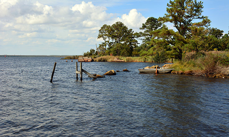
I wanted to know specifically what
vegetation lined the banks of the Pungo
River
Looking toward Jordon Creek
Slade Creek
Upper Slade Creek near Sladeville
Pictures near Belhaven, which is
north of where I place Aquascogooc
Pictures near Pantego Creek
Now to narrate the battle.
No comments:
Post a Comment