Writing "Alsoomse and Wanchese" -- Geography
To begin to develop an understanding of the Algonquian
people that inhabited North Carolina ’s Outer
Banks and coastal shores of Pamlico and Albemarle Sounds and the lower portion
of the Chowan River
Print this out, if you would, for reference as you read this
and future posts.
The Outer Banks,
which are narrow extensions of sandy terrain, extend about 175 miles from the
boundary line between Virginia and North Carolina to below Cape Lookout
(not revealed on your map). The Banks are separated from the mainland of North Carolina Atlantic Ocean . These inlets are in a constant process of
change.
At Cape
Hatteras Gulf Stream
currents flow close by, creating a warm atmosphere that permits tropical fruits
and plants to thrive. North of the Cape, the Gulf Stream
swerves away from the coastline and meets cold water coming down from the
Labrador Current, resulting in much turbulence and a serious threat to
shipping.
The raw sand of the Banks contains mineral content necessary
to stimulate the growth of abundant vegetation. Frequent rainfall has forced
the salt content of the sand downward and to the sides of the Banks, and a
shallow water table of fresh water exists between the salt water table level
and the surface of the Banks. Shallow wells are able to draw fresh water upward
from almost any location on the Banks.
Pamlico Sound dominates that area of water between the Banks
and the mainland of North Carolina Roanoke
Rivers Pamlico Sound .
Inlets to the sounds are filled primarily by southbound ocean
currents. New openings are created by the force of fresh water seeking access
to the sea. Autumn, more specifically September, is when inlets are usually
opened or enlarged.
As the eye of a hurricane approaches the Banks from the Caribbean , winds from the east blow great quantities of
ocean water through the existing inlets and push this water as well as much of
the water in the sounds well up into the many bays and estuaries of the
mainland. When the eye of the hurricane moves north of the Banks, the winds’
direction reverses. Water is pushed across the shallow sounds against the
Banks. Old inlets are reopened; new ones are formed.
The number of inlets has varied considerably over the years.
At times there have been as many as eleven small inlets that release an average
of fifteen billion gallons of water each day into the Atlantic .
At other times three fairly large inlets have done so. Since the Banks became a
part of recorded history, twenty-five different inlets remained open long
enough to receive names and appear on maps. The inlet named Port Ferdinando is the inlet that
Captains Amadas and Barlowe used to enter Pamlico Sound just south of Roanoke Island in 1584.
It closed sometime before 1657.
It was the main entry point of men and supplies for the 1585-1586 Roanoke Oregon ,
was caught on Pamlico Sound . Its crew witnessed the sudden formation of
the new inlet and reported it upon reaching safety. Oregon Inlet exists today.
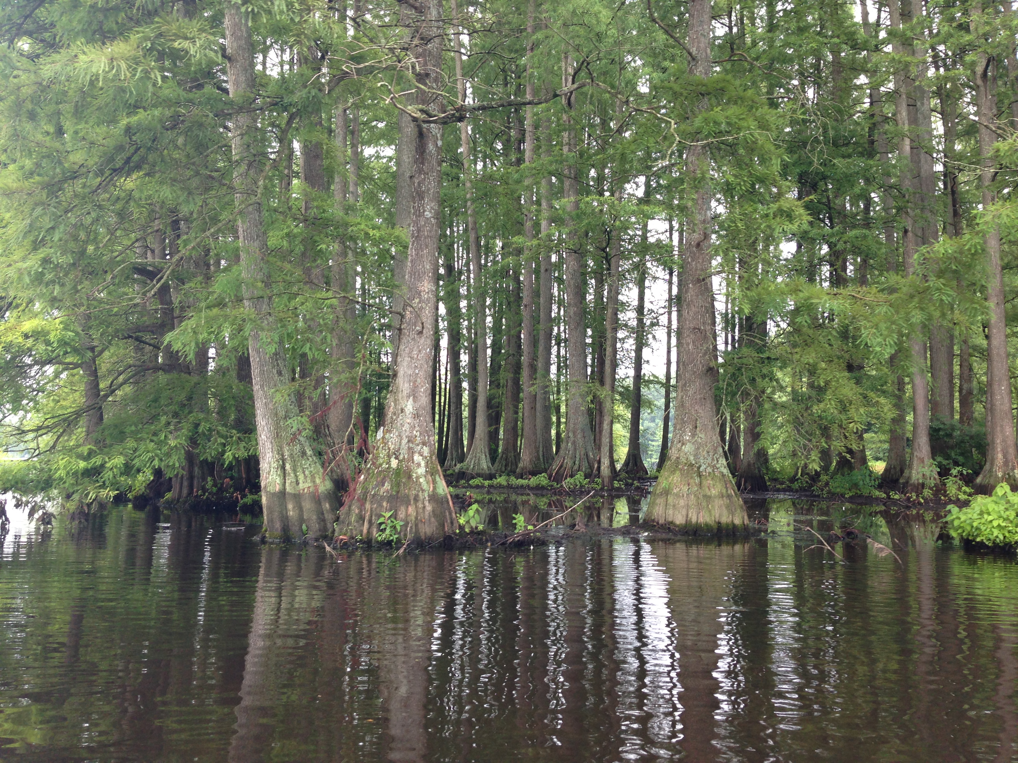
The Chowan River
is nearly two miles wide as it empties into Albemarle
Sound near present-day Edenton (town #26 Warawtan on your
map). The river begins at the North
Carolina-Virginia border where the Blackwater and Nottoway
rivers meet. Flowing some 65 miles, it
is fed by numerous swampy creeks and streams.
Along with the Roanoke River, it supplies most of the fresh water of Albemarle Sound . Surrounded
by one of the most extensive swamp forests in the state, the Chowan River Chowan
River
![http://media.photobucket.com/user/jimmyd8/media/Jimmy%20Ds%20Photography/4911189-1.jpg.html?filters[term]=chowan%20river&filters[primary]=images&filters[secondary]=videos&sort=1&o=12](http://media.photobucket.com/user/jimmyd8/media/Jimmy%20Ds%20Photography/4911189-1.jpg.html?filters%5bterm%5d=chowan%20river&filters%5bprimary%5d=images&filters%5bsecondary%5d=videos&sort=1&o=12)
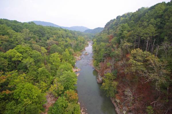
The
Roanoke River stretches for 137
miles across North Carolina Virginia Virginia and enters northeastern North Carolina Albemarle
Sound (see Indian village #24, Tandaquomuc). “The river’s floodplain contains the largest
intact and least-disturbed bottomland hardwood forest ecosystem remaining in
the mid-Atlantic region. The middle section of the Roanoke
River is characterized by alluvial forests and large backswamps,
while the lower section contains vast tracts of bald cypress and water tupelo
swamp forests. The Roanoke River provides a
haven for a host of plants and animals, including more than 200 bird species”
(Roanoke River Region 1). Because the river originates in the
mountains, unlike the Chowan
River River
of Death
An estuary “is
any place where freshwater joins and mixes with saltwater. But more typically,
an estuary is defined as a partially enclosed coastal body of water, having an
open connection with the ocean (for example, via a river), where freshwater
from inland is mixed with saltwater from the sea. Estuaries typically occupy
coastal areas where effects from the ocean are reduced but still
influential. … Estuaries contain salt water and fresh water
in different proportions over the length of the estuary and over the course of
the day, with more salt water during high tide and less at low tide. Because
they are shallow …, sunlight penetrates the water, allowing plants to grow. The
rivers that feed the estuaries deposit sediments rich in nutrients, which
settle onto the sand and mud of the estuary floor. These conditions create
unique habitats for both plants and animals, and provide an environment for
biological diversity in species (of fish, shrimp, crabs, clams and oysters)
that are able to adapt to the brackish conditions. Estuaries are also good
nurseries as they provide a place for these species to hatch and grow before
they migrate to the sea to live out their adult lives. …
“Sand bars buffer the impact of waves, while plants and
shellfish beds anchor the shore against tides. Swamps and marshes take the
initial impact of high winds moving in from the ocean, soak up heavy rain and
storm surges, and release the extra water gradually into rivers and groundwater
supplies.
…
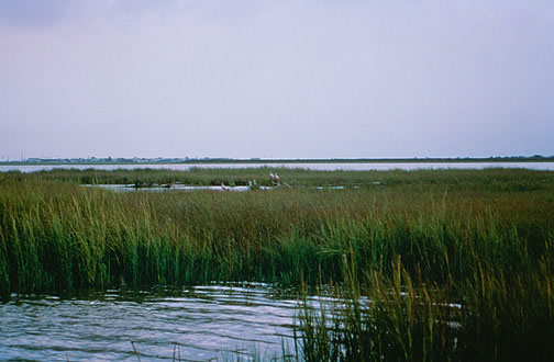
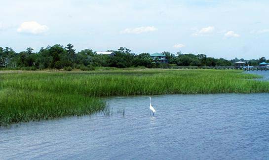
“Swamps and marshes along the edges of the coast provide
feeding grounds and shelter for many adult fish and shellfish. Cypress
Here are links to pictures of estuaries and marshes in Pamlico Sound .
Here are links to pictures of trees frequently found in
swamps.
pond cypress -- http://pics.davidbroadwell.com/Landscapes/North-Carolina/Rhodes-Pond/i-92qCphN/0/XL/_DSC2121-XL.jpg
swamp maple -- http://www.nature.org/cs/groups/webcontent/@web/@newyork/documents/media/prd_026659.jpg
The Algonquian natives of Pamlico and Albemarle Sounds were
water people well adapted to their environment.
They utilized large canoes hollowed out of tulip trees and white cedar. In deciding the locations of their villages,
they “tended to favor the northern shores of the region’s sounds and
rivers. In summer, the prevailing
breezes come out of the south, blowing the northern shores free of
mosquitoes. Winter storms originated in
the Northeast, with the southern shores lying much more exposed” (Oberg 12).
Historians use tribal names to differentiate Native American
populations. A North Carolina Algonquian
“tribe” was usually a loose confederation of two or more villages whose
inhabitants accepted the authority of one leader -- called a weroance – who
made decisions to preserve intra- and inter-village harmony and achieve and maintain
peaceful relations with rival tribes. On
your map, take notice of these “tribes’: Chawanoke, Weapemeoc, Roanoke Roanoke island of Roanoke
The Weapemeoc
villages were all located along the northern bank of Albemarle
Sound . Their head weroance in
1584 was Okisko. He had installed his highest
subordinates over “the towns of Pasquenoke [#16], Chepanoc [#4], Rickahokinge [not
on the map], and Masioming [#8] … Still, Okisko could not control all the
inhabitants in these villages” (Oberg 17) …
The Weapemeocs were not particularly friendly with the Roanokes.
The Chowanokes
were the most powerful and influential confederation of the coastal North Carolina
Algonquians. Their weroance, Menatonon,
was a frail old man when the English encountered him in 1586. Nevertheless, he had under his authority
hundreds of warriors. Villages located on
both sides of the Chowan
River Virginia Jamestown
The Moratuc are
believed not to have been Algonquian. Tribes
west of Algonquian settlements – Mandoag, Eno-Shaikori, and Tuscarora – were
either Iroquois or Siouans. Aggressive
traders, they were the Algonquians’ worst enemies. The Pomouik, probably not Algonquian, were hostile to the southern
Pamlico Sound Algonquians. Several years
before the English made their first appearance on Pamlico
Sound , they had killed in a singular act of treachery many Secoton
(#23) villagers.
These are the villages and the sounds, rivers, waterways,”swamps,
swamp forests, bare sandy deserts and fertile oases” (Quinn 44) that will
appear in my historical novel “Alsoomse and Wanchese.” What historians know about these Algonquians
and the events that transpired after Englishmen first encountered Wingina’s
people and what they speculate may have happened thereafter offer people who
write stories about the past rich material.
Sources Cited:
Harrell, Waverly and Godwin-Myer, Jennifer. “Estuaries in North Carolina UNC School
Oberg, Michael Leroy.
The Head in Edward Nugent’s
Hand. University
of Pensylvania Press , Philadelphia
“Roanoke River Region. The
National Conservancy. http://www.nature.org/ourinitiatives/regions/northamerica/unitedstates/northcarolina/placesweprotect/roanoke-river-region.xml. Net
Quinn, David Beers. Set Fair for Roanoke University
of North Carolina Press, Chapel Hill , 1985.
Print.
No comments:
Post a Comment